

Gulvain [Gaor Bheinn]
Good walks are even better shared.
NN0087 : Dragon's Breath
Adam Ward Photo source
Overview
Gulvain [Gaor Bheinn]
Overview
Gulvain, affectionately known as Gaor Bheinn, rises proudly at 850 meters and is often a quiet alternative to the bustling Ben Nevis. This Munro invites hikers with its striking terrain and captivating views, perfect for those seeking both challenge and tranquillity.
Geology
Gulvain is a geological wonder, primarily composed of granite and schist, shaped by eons of natural forces. These formations create a dramatic landscape, ideal for photography and geology enthusiasts alike. The interplay of these rocks offers a glimpse into the Earth’s history - an ancient tale carved in stone.
Routes
The popular Gulvain Circuit starts in the quaint village of Strone. It spans 14 kilometers and takes about 5 hours to complete, making it a moderate trek suitable for those with a reasonable level of fitness. You'll traverse lush green slopes punctuated by rocky outcrops - a delightful combination.
Summit Features
At the top, you will find a substantial stone cairn that stands as a testament to milestones achieved by many. The vistas are nothing short of breathtaking, rewarding your ascent with stunning panoramas of the encompassing landscapes.
Terrain
Expect a mix of rocky and grassy terrain throughout your hike. Proper footwear is a must, as some sections can become tricky, particularly when negotiating rocky outcrops.
Views
The views from Gulvain are fantastic! You can see the mighty Ben Nevis rise to the south and the shimmering Loch Eil to the west. The scenery shifts beautifully with the seasons, making every hike a potential discovery.
Hazards
Be vigilant of the swiftly changing weather—those Highland mists roll in faster than you can say 'lovely day for a hike!' Rocky sections may be slippery after rainfall, so tread carefully.
Nearby Summits
For the summit baggers out there, nearby summits include Meall na h-Aoidhe and Sgurr Thuilm, each offering unique challenges and views.
Access
Parking: Convenient roadside parking is available near Strone. Be sure to park considerately.
Public Transport: A local bus from Fort William can get you to Strone, but check the timetable because they don’t hang around!
Nearest Town: Fort William is a flourishing town equipped with all the facilities a hiker could need.
Facilities
During your expedition, Fort William provides ample facilities including cafes, shops, and toilets. A great place to refuel after conquering Gulvain!
History
The name Gaor Bheinn reflects the rich Gaelic heritage of the region, while the mountain itself whispers tales of centuries gone by, of clans and their skirmishes, echoing in the winds that swirl around its peaks.
Conclusion
Gulvain is more than just a hike; it's an experience steeped in natural beauty and Highland charm. So lace up those boots, pack a snack or two, and hit the trail!
Explore routes near Gulvain [Gaor Bheinn]
Walks starting near this hill. Open a route to check its map, distance and full itinerary.
Banavie to Glen Loy Aqueduct: Neptune’s Staircase Canal Towpath
View route
Ben Nevis via Mountain Path
View route
Fort Augustus to Kytra Lock: Caledonian Canal Towpath
View route
Glen Affric: Coire Loch Woodland Trail
View route
Route planning notes
These notes describe possible approaches. Check a route's map and access information when planning your walk.
Gulvain Circuit
A scenic route starting from the village of Strone, leading across grassy slopes and rocky outcrops to the summit, providing a full immersion into the Highland landscape.
Make a day of it, together
Find someone to share the walk with, or organise a day out along a route you like.
Photo Gallery
View all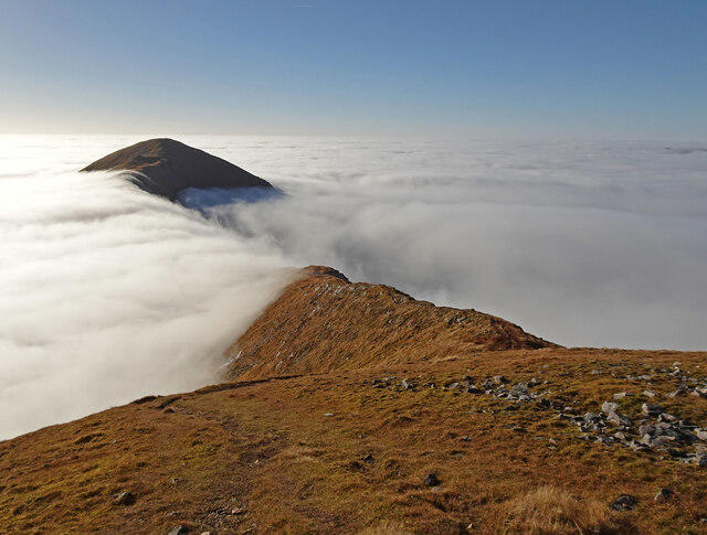 Photo could not load
NN0087 : Dragon's Breath
Adam Ward
![NN0087 : Gulvain [Gaor Bheinn]](https://cdn.walkmates.com/gallery-images/8ff3c8ed3f0c4d78a2e574e25bbe8354.jpg) Photo could not load
Photo could not load
NN0087 : Gulvain [Gaor Bheinn]
Rude Health
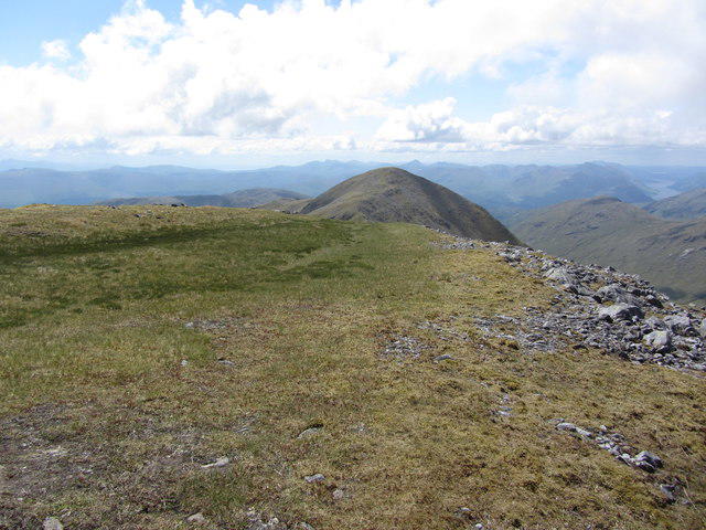 Photo could not load
NN0087 : On Gulvain (main summit) - View towards southern top
Colin Park
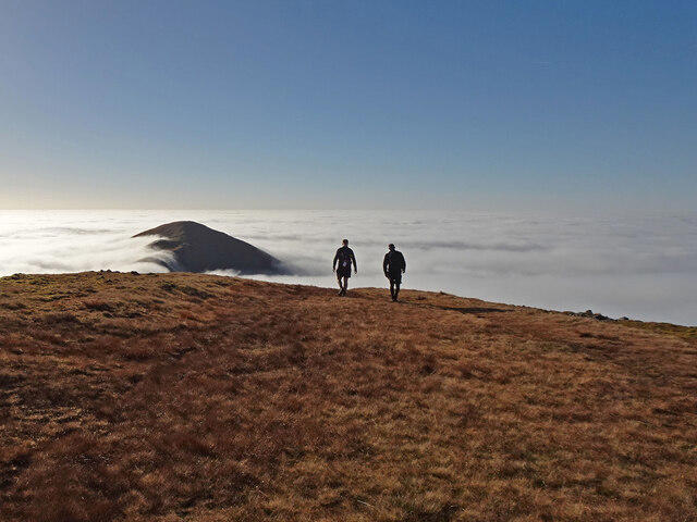 Photo could not load
NN0087 : Walking on Cloud
Adam Ward
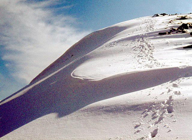 Photo could not load
NN0087 : North top of Gulvain
Alan Reid
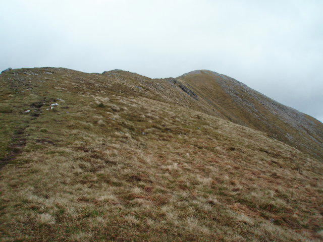 Photo could not load
NN0087 : Approaching the summit of Gulvain
Chris Eilbeck
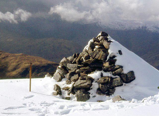 Photo could not load
NN0087 : Summit cairn, North top of Gulvain
Alan Reid
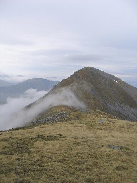 Photo could not load
NN0087 : Gulvain summit
Ali Ogden
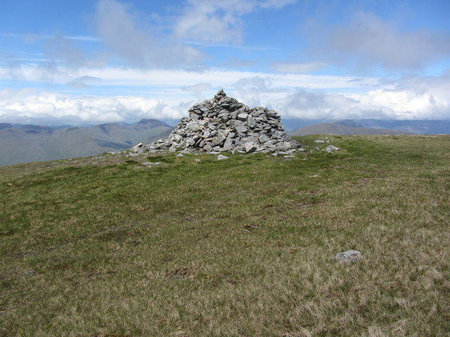 Photo could not load
NN0087 : On Gulvain (Main summit) - The cairn
Colin Park
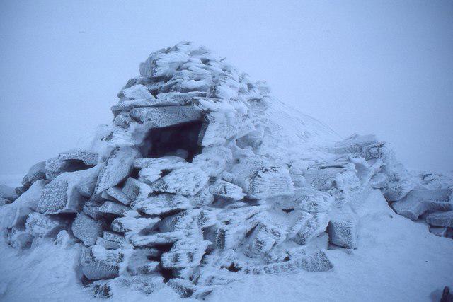
NN0087 : Frosted summit cairn, Gulvain
Jim Barton
Hill facts and local notes
Classifications
Elevation
987m
3,238 ft
Prominence
842m
Coordinates
56.9362, -5.2845
NN002875
OS Map
41
Explorer: 399
At the Summit
The summit of Gulvain is adorned with a substantial stone cairn and offers panoramic views of the surrounding peaks, making it a perfect spot for a well-deserved break and photographs.
Terrain & Geology
Gulvain boasts impressive granite and schist formations, reflecting the profound geological history of the Scottish Highlands. These rocks were formed during significant tectonic movements and are a wonderful example of the rugged beauty typical of this region.
Views & Scenery
From the summit, view the majestic Ben Nevis to the south and the picturesque Loch Eil to the west. On a clear day, the coastal outlines further afield can add to the awe-inspiring scenery.
History & Heritage
Name Origin
The name 'Gaor Bheinn' is derived from Gaelic, meaning 'the mountain of the sound'.
Historical Significance
Gulvain provides not only natural beauty but also historical context, as it stands witness to the rich cultural heritage of the Highlands, including tales of clans and ancient battles.
Getting There & Facilities
Parking
Parking is available at the roadside near the village of Strone, approximately 2 miles from the trailhead. Please be considerate of locals when parking.
Public Transport
The closest public transport option is a bus service to the village of Strone from Fort William. Please check local schedules as they may vary.
Nearby Facilities
Fort William offers various facilities including cafes, shops, and toilet facilities. Ensure to stock up before your hike.
Safety Information
Known Hazards
- Watch out for sudden weather changes common in the Highlands, and be cautious on rocky sections that can become slippery, especially after rain.
General Safety Tips
- Check weather conditions before setting out
- Carry appropriate clothing and equipment
- Let someone know your planned route
- Take a map, compass, and GPS device
- Carry emergency supplies: food, water, first aid kit, torch
Hills
Some common questions about the hills answered
Are there group walks up Gulvain [Gaor Bheinn]?
Many walkers use Walkmates to join or organise walks with others. You can check for group walks around Gulvain [Gaor Bheinn] through the maps
Are there other walkers around Gulvain [Gaor Bheinn]?
Activity varies by location and time, but Walkmates lets you see whether others have shared walks or shown interest in this area. Find other people through the walking friends search walking friends for Gulvain [Gaor Bheinn] search or of course create your own walk for Gulvain [Gaor Bheinn]
Can I organise a walk to Gulvain [Gaor Bheinn]?
Yes. If there aren’t any walks listed already, you can create a walk and make it available for others to join.
If you're signed up to Walkmates, you can create a walk to Gulvain [Gaor Bheinn].
How do I find a walk up this hill?
There are often multiple ways to walk this hill, depending on experience and route preference. Walkmates helps you explore walks and routes that others have shared.
Can I suggest a new route up Gulvain [Gaor Bheinn]?
Yes. You can suggest or create routes to share with others. Walkmates focuses on the social side of walking, so routes are used to help people organise walks and explore areas together, rather than as detailed navigation tools or route libraries.
Other uses really appreciate knowledgeable walkers sharing their routes. Share your favourite route to Gulvain [Gaor Bheinn] here
The is an error or something incorrect about this hill. How do I let you know?
We always strive to keep the information on Walkmates as accurate as possible. If you find an error, please let us know through the contact form and we'll aim to correct it as quickly as possible
Community Discussion
Comments
Location
![Gulvain [Gaor Bheinn] location map](https://cdn.walkmates.com/hill-maps/hill-sources/773/56.93621_-5.28453.png)
Grid reference: NN002875
View on OpenStreetMapOpens a map in a new tab, centred on the hill.
No comments yet. Be the first.